
I presented original research at the International Associate of Landscape Ecology, North America, conference in April 2021.
My poster presentation was the culmination of a yearlong virtual internship with The Nature Conservancy, where I learned the programming language R and software GIS in order to create data visualizations of data about historic fire amounts in North America. This amazing opportunity expanded my interest in environmental science and taught me valuable skills in coding.
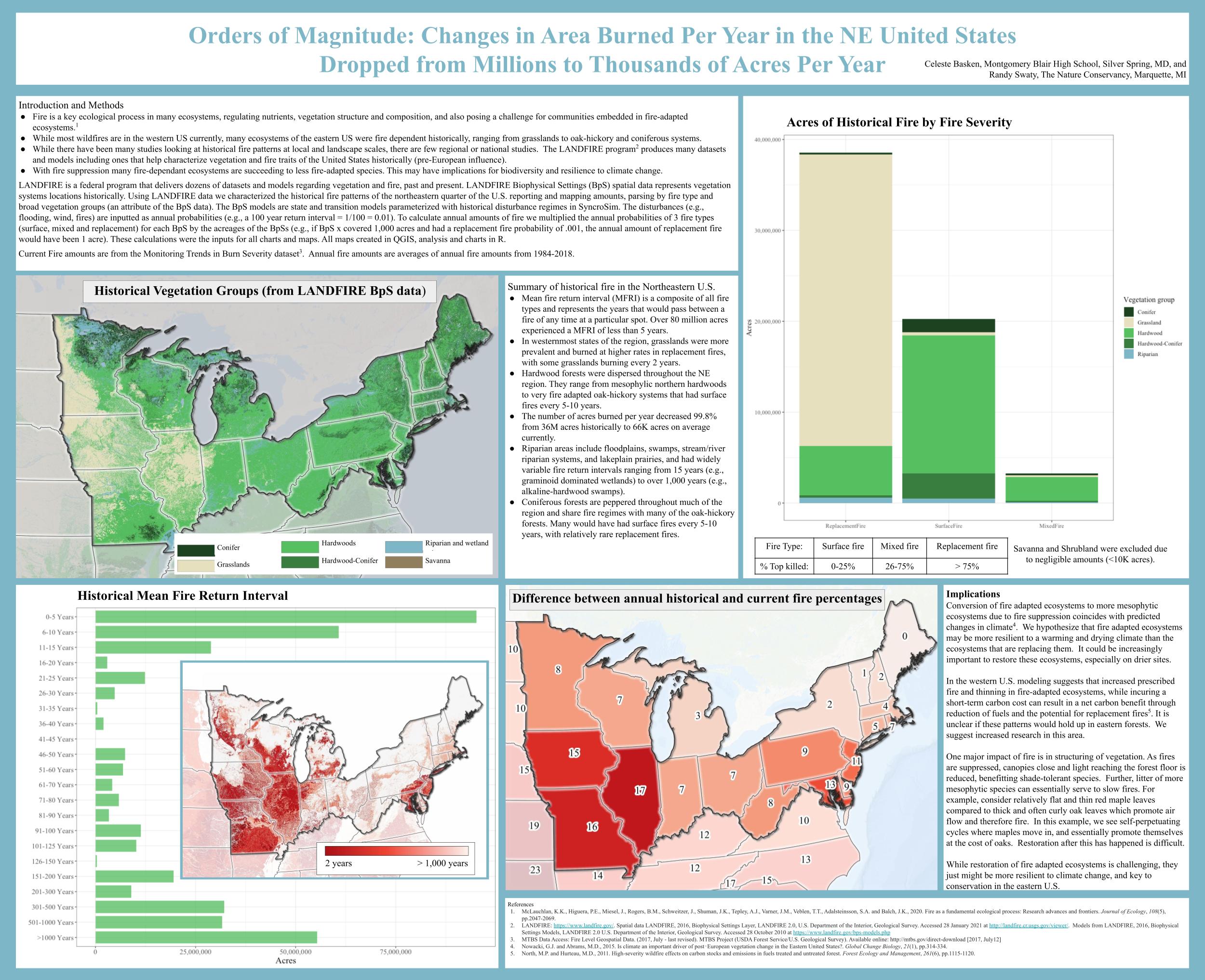
Fire is an integral process in many ecosystems, driving vegetation structure and composition. Historically, fire played an important role in many of the ecosystems of the northeastern United States, especially south of the Tension Zone. While historical and current fire patterns have been analyzed locally, current region-wide quantitative analyses are lacking. Using LANDFIRE and Monitoring Trends in Burn Severity datasets we contrasted historical and contemporary fire amounts and severities for the region. This analysis, completed in ArcMap, SyncroSim and R revealed 1) which ecosystems historically experienced the most frequent fire, 2) how fires of different severities compared past and present, and 3) how fire amounts compare across the 20 states of the region we assessed. In general the region is predicted to become warmer, with precipitation becoming more erratic and reduced. If this comes to pass, fire adapted ecosystems may be more resilient to those conditions. Understanding the fire regimes past and present will allow managers to identify and implement more effective restoration and suppression strategies.
Authors: Basken, Celeste; Swaty, Randy